
6/22/16
Dangerously high winds will be possible tonight here in West Central Ohio along with heavy rain that could lead to flooding and perhaps an isolated tornado or two. This is easily the highest threat for severe weather we have had in 2016 so it would be a good idea to secure any outdoor items and have a safety plan in place as storms move in between about 10 PM and 2 AM Thursday morning.
Let’s get down to the details:
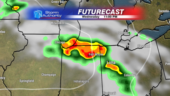
How is this storm going to develop? An area of low pressure and warm front will be moving over Northern Illinois late this evening that will likely spark what is called a Mesoscale Convective System (MCS). As I mentioned in my previous blog post, an MCS is a large and organized area of thunderstorms that typically persists for several hours. They usually congeal or develop into a well-defined bow echo that can bring widespread wind damage to a region. Sometimes MCS’s can be classified as a Derecho, but that doesn’t happen until AFTER the storm has ended based on how widespread and long-lived the wind damage is. Here is where I’m thinking the MCS will develop around 9 PM tonight.

The system will evolve and move through Northern Indiana heading towards the midnight hour.
And probably enter Western Ohio after midnight.
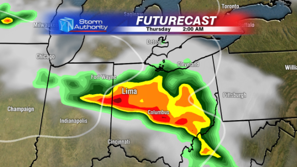
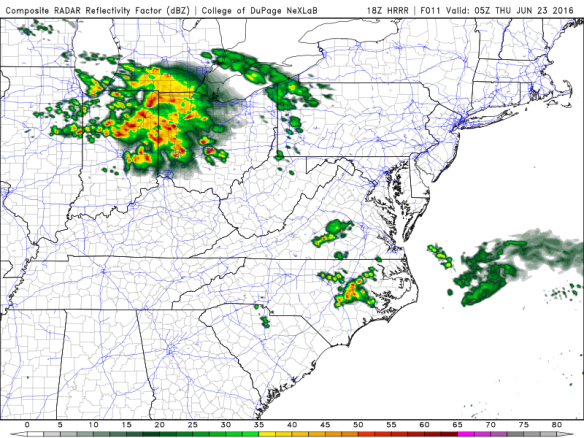
Other forecast models confirm this arrival time, there has been high consensus among different models giving me pretty high confidence in an arrival time from 11:30PM to 12:30AM into West Central Ohio. Here is a look at another model, the HRRR around 1 AM.
What can we expect from this storm?
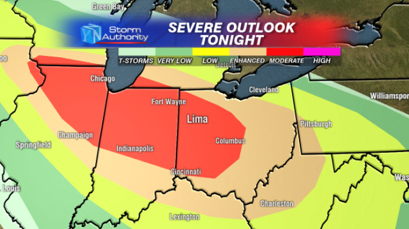
A lot. High wind, heavy rain, and even a few isolated tornadoes. The National Weather Service continues to keep the region under a “Moderate Risk” for severe weather. We don’t see this high of a risk very often, and because of that should be taken very seriously.
How bad will the storm be?
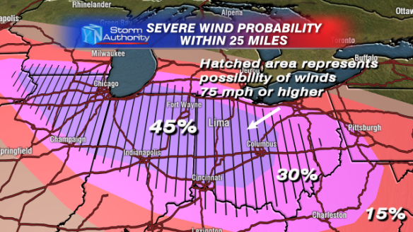
My biggest concern is high winds. Here is a look at the probability of winds over 58 miles per hour within 25 miles of any given point on the map. Notice the black hatched area, that means that within that area the possibility exists to see winds topping 75 miles per hour with storms, that’s hurricane force.
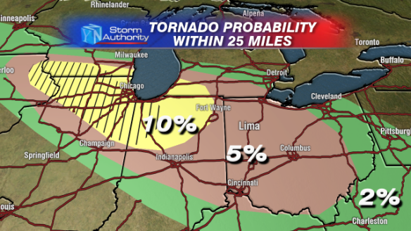
I’m worried about isolated tornadoes too, but to a lesser extent. Here is a similar probability map but for tornadoes. 5% isn’t very high, but there is definitely a chance that a few storms could spawn a short lived tornado or two.
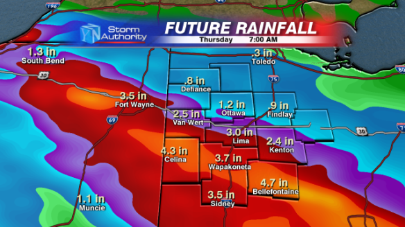
And I can’t forget the rain. We could see lots of rain, especially south of Route 30. Here is a look at the possible rain totals in the region through Thursday morning.
Again, the timeframe for these storms is in the 10PM to 2AM timeframe. Once the system develops later this evening I will begin to narrow that down. I’ll definitely keep you updated through the evening and stay up to the latest radar with our Weather App!
-Kyle
